


Geolocating Place subdivisions
Geolocating Place subdivisions https://help.heredis.com/wp-content/themes/corpus/images/empty/thumbnail.jpg 150 150 Heredis Help Knowledgebase https://help.heredis.com/wp-content/themes/corpus/images/empty/thumbnail.jpgPlace subdivisions can now be geolocated. The Place Subdivision field is intended for specific details on a place, such as an exact address, a hamlet, or any other place name.
Edit
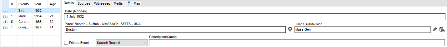
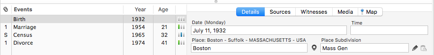
To access this feature, select an event under the Personal Data tab. Click on the Details tab then on the pencil ![]() button displayed to the right of the Place subdivision field.
button displayed to the right of the Place subdivision field.
(Windows) Details tab for an Event
(Mac) Details tab for an Event
You may also access it from Places Index > Subdivision then click on the pencil ![]() button.
button.
Since Heredis 2022, you can add a subdivision in the Place Index by clicking on ![]() and delete it by clicking on
and delete it by clicking on ![]() the on the Subdivision tab of a location.
the on the Subdivision tab of a location.
(Windows) Places Index

(Mac) Places Index

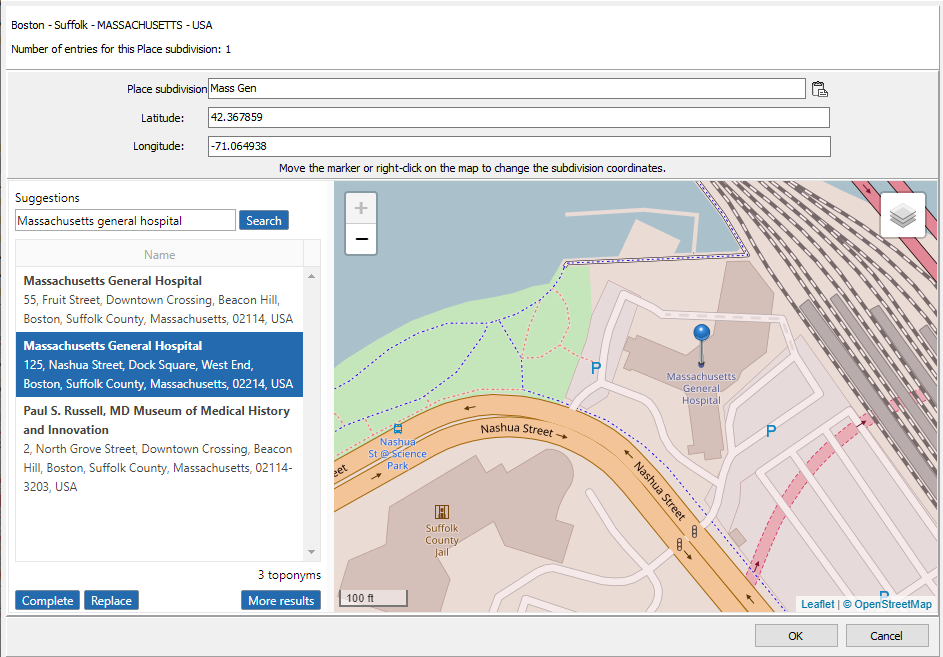
You can enter the name and coordinates manually or paste a place’s data (in its entirety or only the coordinates) by clicking on the ![]() button.
button.
See the article entitled Zoom in on a Place for more details.
Search
If the subdivision name is precise enough, Heredis will perform an automated pre-search. Browse through the list of propositions.
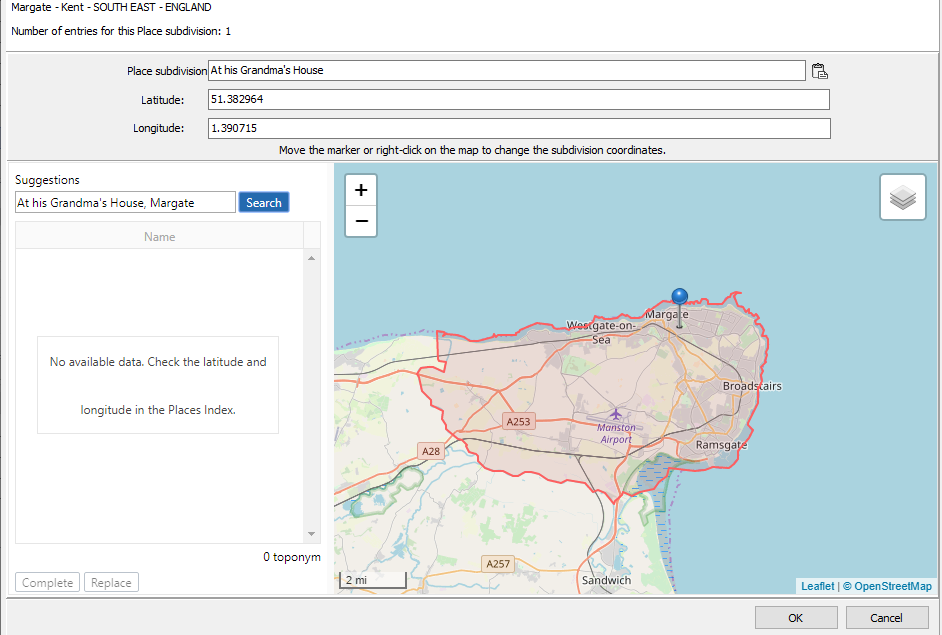
If your subdivision cannot be located – for instance « at her grandma’s house » – Heredis will not be able to offer any potential geolocation. You should therefore modify the field content under Suggestions then click on Search to launch the search again.
Note: Avoid using commas and unnecessary spaces at the end of the text in the Subdivision field to ensure that the automated search will be able to find the designated places.
Edit a non-geolocated subdivision
In the same way you search for a place’s geolocation (please refer to Geolocation), click on:
• Fill up to keep the subdivision name and add coordinates,
• Replace to replace all data previously entered for the subdivision.
Click OK to validate.
If you know where the person’s grandmother used to live and prefer to leave « at her grandma’s house », then drag and drop the marker or right-click on Position the marker here.
Coordinates (latitude and longitude) will then be displayed.
(Windows) Edit an unrecognized subdivision
Display
From the Places Index
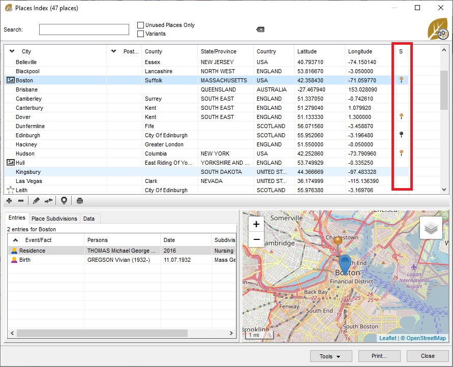
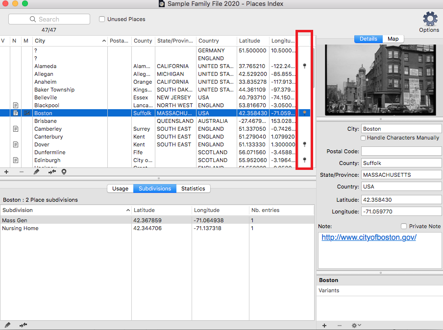
In the list of places, the S column will display markers to indicate whether there is one subdivision or more. When they are not geolocated, the marker is black . When at least one subdivision has been geolocated, the marker is yellow .
(Windows) Places Index – The S Column
(Mac) Places Index – The S Column
From maps
Subdivisions are visible thanks to yellow markers on the Events maps, Zoom in on a Place maps, as well as on Migrations maps (under the History tab).
You can right-click on any of the Heredis maps and Copy the coordinates. You will then be able to click on the Paste ![]() button in the Place subdivision field under Events. However, to be able to do so, make sure a name has been entered in the subdivision field – otherwise the button will not be activated.
button in the Place subdivision field under Events. However, to be able to do so, make sure a name has been entered in the subdivision field – otherwise the button will not be activated.